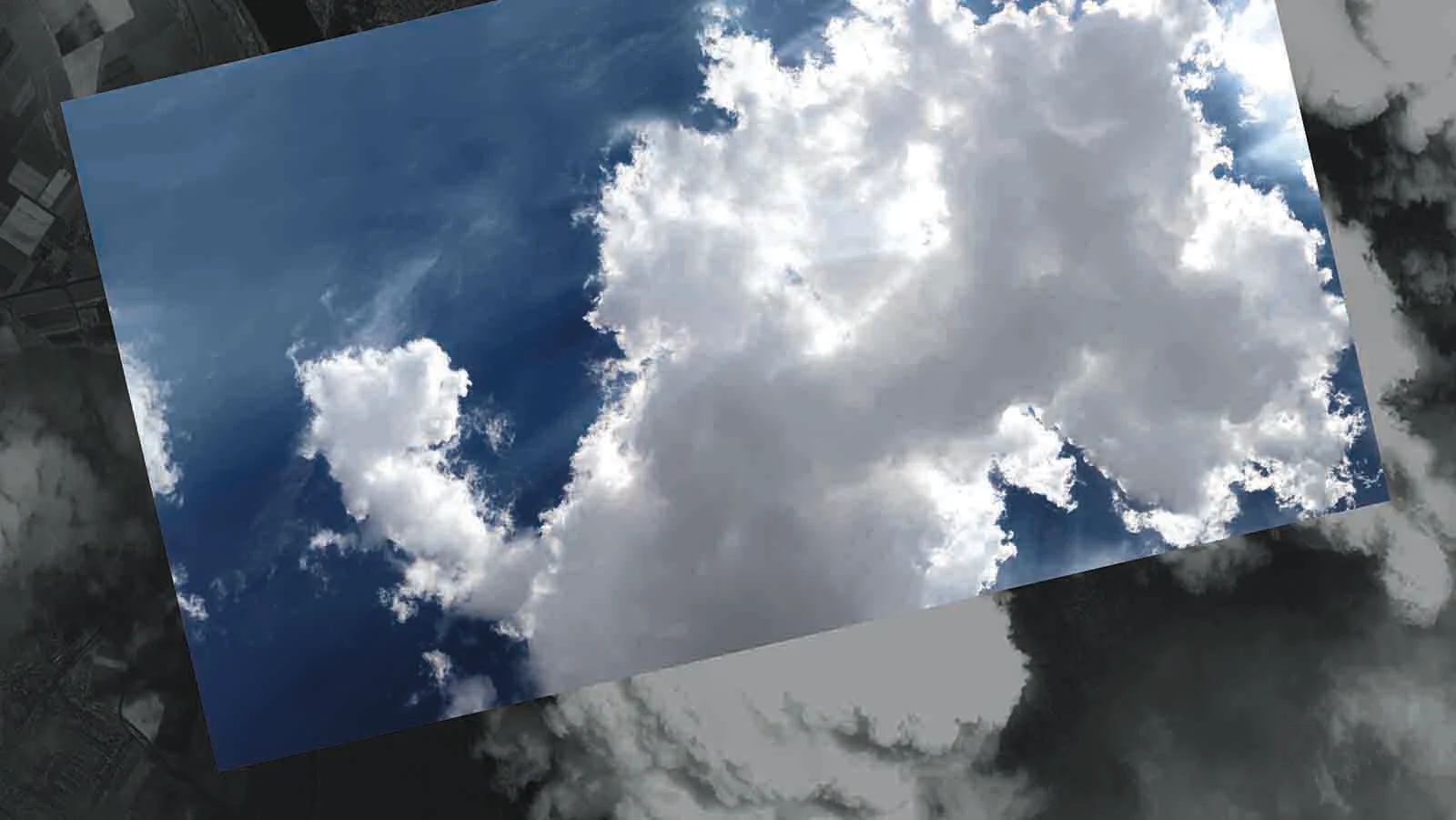
Lyoudmila Milanova with her photo series "Seeing clouds from both sides"

Clouds - Photo: Lyoudmila Milanova.
Short profile
Lyoudmila Milanova studied theatre, film and television studies at the University of Cologne and subsequently completed a degree in media art at the Cologne Academy of Media Arts.
In her artistic practice, she explores the relationship between nature and artificiality. It is primarily ephemeral substances such as mist, clouds or light that are the focus of her works, where they encounter man-made constructs, be it through technology or spatiality. Her installations and videos have already been awarded numerous grants and funding prizes and exhibited internationally. Currently, the artist is represented with a kinetic cloud sculpture at the Kunstmuseum Bonn as part of the exhibition "Welt in der Schwebe".

3 QUESTIONS TO LYOUDMILA MILANOVA
How did you come up with the idea?
I had the idea for the photo series in 2015/2016. I first had to find a satellite company and convince them to support me. That took a few months. In the end, I was able to win over an American company that is based near Washington DC, at NASA's premises.
What interested me most about the idea was its feasibility: Is it possible, as an observer of a cloud from Earth, to synchronise myself with a satellite and form a line of sight with its camera for a brief moment? There were also other attractions to this idea, such as the naivety of the desire to see a cloud from both sides in real time, contrary to the technology needed to realise it. And of course, one can also read a kind of arrogance of man towards nature, who desires this kind of asymmetry between effort and meaning and achieves it through technology.
How can we imagine the process behind this?
After I got the company Orbit Logic from Washington D.C. to work on my project, it started. The satellite that had to shoot the photo from above first had to be reprogrammed, because I wanted to photograph clouds, not the earth. Normally they only trigger when the sky is clear. The process itself was such that I determined my position on the earth and transmitted its GPS coordinates to the company. Every time the conditions were good enough for a photo from above (meaning: the satellite camera was at 90° to my position if possible and there were some clouds above my head), I got a notification and knew to the second when the satellite would trigger from above.

Aerial photograph of a city with clouds - Photo: Lyoudmila Milanova.
There are also many anecdotes about this, for example when the position I had determined was suddenly occupied by a football team or a family of ducks and I still had to place myself in the middle of it with cameras because that gave the best angle to the satellite. In any case, it turned out over time that it is not at all easy to hit the ideal conditions so that the perfect cloud hovers over you and exactly then, the satellite is also ready to trigger. It took about a month each time to get a single usable result.
How is the visual realisation of the different views done in the end?
Bringing the two views together photographically was not easy. The distance between the satellite and the cloud was of course much greater than between me and the cloud. The photo section I got from the satellite covered an area of 10 x 10 km from my position as the centre of the image. The resolution of the satellite image was about 1m or 1 pixel = 1 metre. In order for me to photographically capture an entire cloud formation, I had to use the photo stitch method: I was able to achieve a larger cloud section from many individual images stitched together. I did the photo shoot with a Sony Alpha 7s camera, with a ZEISS Batis lens (2.8/18) and at the same time I recorded the cloud formation with a Go Pro camera as a video, which served as a reference for later photo editing.
The colourfulness of both shots came naturally: the satellite shot came with little to no colour information. Either the image had a strong magenta cast that was difficult to remove or it was heavily desaturated, so the black and white aesthetic was the best solution. This was in contrast to the perspective from Earth, which mostly showed bright blue.

